Settings
Shipping Country
Languages
- Products description
- Reviews
- Manufacturer Information
Products description
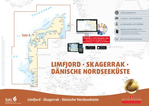
Delius Klasing, Nautical Chart Set 6 Limfjord Skagerrak Danish North Sea Coast, Print + Digital Edition 2020 / 2021 covers the sea areas between Sylt and the northern part of the Danish Kattegat coast. The set of nautical charts includes: 4 1:300000 over-sailors, 22 1:35000 - 1 .80000 area and detailed charts, accompanying booklet with 56 harbour plans and waypoint list. All Delius Klasing nautical charts have the following features:
- Handy pleasure craft format 60 × 42 cm, well thought-out sheet layout with nautically sensible overlapping of the charts
- Each set of charts contains an accompanying booklet with area information, a waypoint list, a symbol legend, harbour plans, text information on the harbours and some harbour photos
- Particularly clear chart image: Land yellow, shallow water dark blue (0-2 m or 0-3 m) and light blue (2-5 m or 3-6 m) Exception: Oversailors: dark blue: (0-5 m) light blue: (5-10 m),
- 3-colour beacon colouring, coloured buoy representation in the actual buoy colour
- Red 2 m depth line as
Red 2 m depth contour as danger line, particularly discreet representation of less important nautical chart data (underwater cables, restricted area lines, depth contours with high depth etc.)
- All general charts cover the entire Baltic Sea at a scale of 1:300,000, district charts are standardised per set, usually at a scale of 1:80,000 or 1:50,000.
1:50,000. Many additional detailed charts at scales between 1:50,000 and 1:6,000. Numbered waypoints
- Annually updated new editions for almost all map sets. Free online correction system and additional printed correction system with coloured cover sheets and complete replacement map sheets for major changes. Online corrections are also available during the water sports season
- Enclosed CD-ROM with simple Delius Klasing navigation software and demo versions. The demo versions contain all the functions of the full versions, but are limited to the enclosed demo charts. With the simple navigation software, the Delius Klasing sports boat chart CD-ROMs can be used as chart plotters when a GPS is connected.
- The sets are supplied in a DIN A2 transparent plastic bag.
This Product was added to our catalogue on 15/07/2011.
Customer reviews
Average rating: 0
Based on 0 Customer reviews
Write the first review please!
Manufacturer Information
Manufacturer: Delius Klasing Verlag GmbH, Siekerwall 21, 33602 Bielefeld
Kontakt: https://www.delius-klasing.de/kontakt/
Kontakt: https://www.delius-klasing.de/kontakt/
This product goes perfectly with:
Last viewed


