Settings
Shipping Country
Languages
- Products description
- Reviews
- Manufacturer Information
Products description
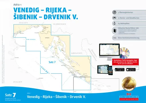
Delius Klasing, Nautical chart set 7 Adriatic Sea 1 Venice - Southern Cornati, paper + digital for the pleasure boat skipper. Northern Adriatic region Italy, Slovenia and Croatia: Venice - Rijeka - Sibenik - Drvenik. The nautical chart set contains the following charts: 3 over-sailors, 25 charts, 69 harbour plans, area guide, waypoint list, CD-ROM with navigation program, download licence for the digital nautical chart for PC, tablet and smartphone. Delius Klasing nautical charts have the following features:
- Handy pleasure craft format 60 × 42 cm, well thought-out sheet layout with nautically sensible overlapping of the charts
- Each chart set contains an accompanying booklet with area information, waypoint list, symbol legend, harbour plans, text information on harbours, some harbour photos
- Clear chart image: Land yellow, shallow water dark blue (0-2 m or 0-3 m), light blue (2-5 m or 3-6 m) Exception: Oversailors: dark blue: (0-5 m) light blue: (5-10 m)
- 3-colour beacon colouring, coloured buoy representation in the actual buoy colour
- Red 2-metre depth contour as
Red 2-metre depth contour as danger line, discreet representation of less important nautical data (cables, restricted area lines, depth contours with high depth etc.)
- General charts covering the entire Baltic Sea at a scale of 1:300,000, area charts per set mostly at a scale of 1:80,000 or 1:50,000. Many additional detailed charts at scales between 1:50,000 and 1:6,000. Numbered waypoints.
- New editions updated annually. Free permanent online correction system, additional printed correction system with coloured cover sheets, complete replacement map sheets for major changes.
- Delivery of the sets in DIN A2 transparent plastic bag.
Customer reviews
Average rating: 0
Based on 0 Customer reviews
Write the first review please!
Manufacturer Information
Manufacturer: Delius Klasing Verlag GmbH, Siekerwall 21, 33602 Bielefeld
Kontakt: https://www.delius-klasing.de/kontakt/
Kontakt: https://www.delius-klasing.de/kontakt/
This product goes perfectly with:
Last viewed


