Settings
Shipping Country
Languages
- Products description
- Reviews
- Manufacturer Information
Products description
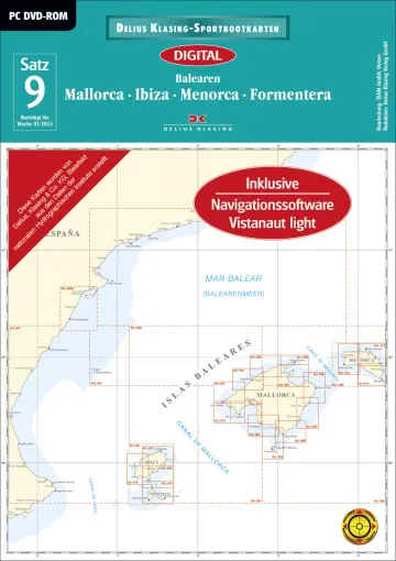
Digital nautical chart set 9, Balearic Islands, electronic nautical chart from Delius Klasing for the sea areas of the islands of Mallorca, Menorca, Ibiza and Formentera. The digital recreational boating charts from Delius Klasing are tailored to the special needs of recreational boating. Compared to the corresponding paper charts, the digital charts contain at least twice as many scale levels. This wide range of scales enables the user to always display the correct image area of the charts on the screen:
- Large scale of the coastal representation of at least 1 : 50000
- Database with waypoint list, harbour plans, harbour photos and text descriptions of the harbours
- Corrected until week 1 / 2012, free online correction twice a year
- Including navigation software Vistanaut Light
The navigation software YACHT NAVIGATOR Premium, NAVIGATOR mobile 3.0 or Vistanaut is required to use the digital pleasure craft charts in Delius Klasing format. Electronic nautical charts are only to be used as a supplement to the official paper nautical chart as a continuous correction is generally not guaranteed!
This Product was added to our catalogue on 12/06/2009.
Customer reviews
Average rating: 0
Based on 0 Customer reviews
Write the first review please!
Manufacturer Information
Manufacturer: Delius Klasing Verlag GmbH, Siekerwall 21, 33602 Bielefeld
Kontakt: https://www.delius-klasing.de/kontakt/
Kontakt: https://www.delius-klasing.de/kontakt/
Our recommendation as an alternative or for completion:
This product goes perfectly with:
Last viewed


