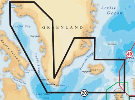
Navionics, vector map + 20XG, Greenland & Iceland
Item No: A105432016
The Navionics XL9 vector map + 20XG, Greenland + Iceland on SD / microSD or CF memory cards. These maps have since become one of the most widely used map standards on chart plotters. A new feature is the ability to use the maps with a special Navionics memory card reader with PC programmes such as the VISTANAUT software. This requires the original Navionics memory card reader. This device decodes the Navionics vector maps on the memory chips:
Greenland West, Greenland South, Iceland. From Northumberland Oe via Cape Farvel to Nathorst Fjord. Incl. Scoresby Sund, Disko Bugt, Melville Bugt, Nuuk in Greenland and Faroe Islands, Shetland Islands, Orkney Islands, Hebrides and North West Scotland from Kyle Rhea to Helmsdale.
Plotter: Raymarine, Furuno, Garmin, Eagle, Humminbird, Geonav, Lowrance, Northstar
Chart type (plotter without guarantee):
SD- Card (Eagle, Furuno, Lowrance, Murphy, Humminbird, Geonav G3)
